
GeoTracker
One tap in the field, the whole week on a map
Street outreach tracking software has to work with one thumb, standing on a sidewalk. GeoTracker logs where an encounter happened in one tap from the client's profile, gathers those logs into places your team names, and puts everyone's week on a supervisor's map. It's in heavy daily field use at a large Oregon agency.
What GeoTracker does
Not a roadmap item. This module is in heavy daily field use at a large Oregon agency, and it shows in the details.
Log it in one tap
From the client's profile, one tap on the quick-action menu records a location log with a Global Positioning System (GPS) stamp. The client's record is attached, and a task is attached when you want one. No form, no typing an address that doesn't exist.
Home visits, verified
For home-visit programs, creating a task can capture a GPS location automatically, so field tasks carry a location stamp without anyone thinking about it.
Logs become places
Locations within about 250 feet of each other cluster into a place automatically. Staff give it the name the team actually uses (the underpass, the camp behind the fairgrounds), then freeze its center so it stops drifting, or move it by hand when the map says otherwise.
The week on one map
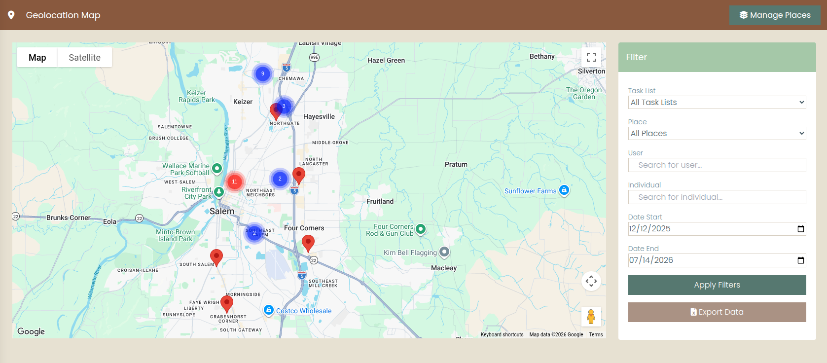
Supervisors see every log on a map with marker clustering, filtered by worker, client, task list, place, or date range. Coverage, gaps, and patterns are visible at a glance instead of assembled from memory.
Proof for funders
When a home-visiting or outreach funder asks you to verify where services happened, every log is a location-stamped answer, and the whole set exports to Excel.
Ready for the PIT count
The Point-in-Time (PIT) count is field logging at its most intense. It is the one-night count of people experiencing homelessness that HUD (the U.S. Department of Housing and Urban Development) asks communities to run. Count teams log each contact where it happens; the map shows what ground was covered.
Questions outreach teams ask
How does logging work in the field?
From the client's profile on a phone, one tap on the quick-action menu creates a location log with a GPS stamp and a timestamp, with the client's record attached, and a task attached when the worker wants a follow-up. There is no form to fill out and no address to invent for a tent site or an underpass.
What is a place, and who controls the list?
When location logs land within roughly 250 feet of each other, GeoTracker clusters them into a place automatically. Your staff give each place the name the team actually uses, freeze its center so it stops drifting as new logs arrive, reposition it by hand, and remove one once it holds nothing. Named places then work as a filter on the supervisor map.
What do funders actually get?
Location-stamped service verification: each log records where and when a service contact happened, tied to a client and a worker. Supervisors filter the map by worker, client, task list, place, or date range, and location logs export to Excel for home-visiting and outreach reporting.
Can we run our Point-in-Time count with it?
Yes. GeoTracker is a strong PIT count tool. The Point-in-Time (PIT) count is the one-night count of people experiencing homelessness that HUD, the U.S. Department of Housing and Urban Development, asks communities to conduct. Count-night teams log each contact where it happens; afterward, the map shows what ground was covered and the Excel export supports the tally.
See it from the sidewalk
Bring your outreach routes to the demo. We'll log a visit from a phone and pull up the map the way a supervisor would on Friday afternoon.